Bamwor Indexes
Jan Mayen — Q1 2026
Jan Mayen Intelligence Report
Download PDF with 20+ statistics, rankings & proprietary indices
Introduction
Background
This barren, mountainous isle located in the Arctic Ocean bears the name of a Dutch whaling captain who is definitively credited with its discovery in 1614 (previous claims lack sufficient evidence). Throughout the years, it has been sporadically visited by seal hunters and trappers, and in 1929, it was officially claimed by Norway. The Beerenberg volcano, which had been inactive for a long period, is recognized as the northernmost active volcano on the planet; it became active again in 1970, with its latest eruption taking place in 1985.
Geography
Area
land
377 sq km
water
0 sq km
total
377 sq km
Climate
Arctic maritime climate characterized by frequent storms and ongoing fog
Terrain
an island of volcanic origin, partially shrouded in glaciers
Land use
other
100% (2018 est.)
agricultural land
0% (2011 est.)
Location
Located in Northern Europe, this island lies between the Greenland Sea and the Norwegian Sea, to the northeast of Iceland
Coastline
124.1 km
Elevation
lowest point
Norwegian/Greenland Seas 0 m
highest point
Haakon VII Toppen on Beerenberg 2,277
Irrigated land
0 sq km (2022)
Map references
Arctic Region
Land boundaries
total
0 km
Maritime claims
contiguous zone
24 nm
territorial sea
12 nm
continental shelf
200-m depth or to the depth of exploitation
exclusive economic zone
200 nm
Natural hazards
The landscape is predominantly shaped by the Beerenberg volcano
volcanism: Beerenberg (2,227 m) stands as Norway's sole active volcano; volcanic activity was reignited in 1970, with the last eruption taking place in 1985
Geography - note
A desolate, spoon-shaped volcanic island that supports limited moss and grass vegetation; the island is divided into two sections: a larger northeast segment known as Nord-Jan (the spoon's "bowl") and a smaller part called Sor-Jan (the "handle"), which are connected by a 2.5 km-wide isthmus (the "stem") featuring two significant lakes, Sorlaguna (South Lagoon) and Nordlaguna (North Lagoon)
Natural resources
none
Area - comparative
slightly more than double the area of Washington, D.C.
Geographic coordinates
71 00 N, 8 00 W
People & Society
Population
total
no permanent inhabitants
Environment
Climate
maritime Arctic characterized by recurrent storms and enduring fog
Land use
other
100% (2018 est.)
agricultural land
0% (2011 est.)
Environmental issues
contaminants carried from southern regions by atmospheric winds and oceanic currents
Government
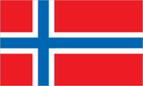
Flag
the Norwegian flag is utilized
Country name
etymology
named in honor of Dutch Captain Jan Jacobszoon MAY, who was among the earliest explorers to arrive at the island in 1614
conventional long form
none
conventional short form
Jan Mayen
Legal system
the regulations of Norway are applicable
Dependency status
region of Norway; since 1994, governed from Oslo by the county governor (fylkesmann) of Nordland; nonetheless, power has been entrusted to a station commander of the Norwegian Defense Communication Service; in 2010, Norway declared most of Jan Mayen a nature reserve
Economy
Communications
Broadcast media
since 1994, a coastal radio station has been functioning under remote operation
Transportation
Military & Security
Military - note
It is the duty of Norway to ensure its defense.